 Having driven up to Norfolk on Wednesday I wanted to have a rest from driving so today I used the Coasthopper bus to get me from Blakeney, where I am staying to Cromer. The buses run once an hour from 9.30 to 5.30 so I just needed to be aware of the time otherwise I would have to do a much longer walk than I planned. The Coasthopper even accepts my London Freedom pass so travel was free. Although the bus travels along the coast road you only get brief glimpses of the sea so I was looking forward to spending some time relaxing on the sandy beaches of Cromer.

However, there was just one problem with this idea. Being a city girl, I never for one minute thought about checking the tide timetables! There would be no sitting on the beach this morning. I decided to have a brief look around the town and then walk back along the Norfolk coastal path.
The impressive parish church has the tallest tower in Norfolk.
Lots of narrow streets make it a small attractive seaside town but of course you can't escape the trappings of the tourist industry.

Cromer's most attractive feature is its pier. This current one was built in 1901.

Looking down you can see a compass with lines radiating outwards. The lines are a representative selection of the direction of a service carried out by the Cromer lifeboat since the station's establishment in 1804.
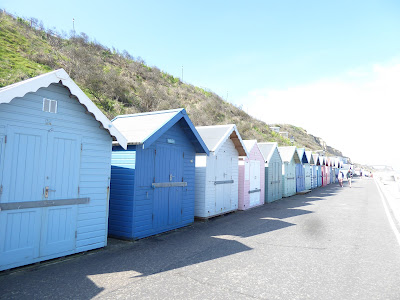
I walked along the promenade admiring the colourful beach huts before climbing up to the cliffs above to join the coastal walk.
On the way I past these copies of old posters advertising the town.

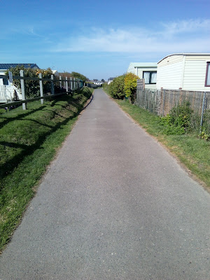
I have to admit for the first 30/40 minutes of walking the North Norfolk Coastal Path, I was very disappointed. Passing caravan parks, walking through camp sites and a long walk along the road meant no views of the sea at all.
Eventually I spotted the sign post taking me off the road and hopefully back on the cliffs overlooking the sea.
But no yet more caravans.
Finally I left the caravans behind and walked uphill back on the cliffs.
At last views of the sea once again.
 Ahead of me is the Beeston Bump. A leftover from when the glaciers retreated at the end of the last ice age 10,000-15,000 years ago. In World War II the Bump was used as a signals intelligence location known as a 'Y' station. The stations got their name from the shortening of 'Wireless intercept stations' to WI station and then just Y stations.
This station was one of several similar units around the South and East coasts. This one was manned by German speaking Wrens. They were posted here from all over the UK. Their aim was to intercept radio signals from the E-boats.
The path continued for a few miles along the cliff top until it reached the small seaside town of Sheringham, when it came downhill to the promenade.
I could have walked along the pebble beach to the next village on route but that would be a slow and tortuous journey so I climbed back up to the clifftop.
I walked beside a golf course for a while before spotting this former coastguard station.
It is now run by volunteers who keep watch over the sea looking for anyone who might in difficulty.
The broom was in flower making a splash of colour.
After about 7 miles I left the coastal path at Weybourne and walked past this former windmill to the coast road and hopefully catch the Coasthopper bus for a few miles.
Across the road from the bus stop are the ruins of an Augustinian priory which stand next to a 15th century church.
The buses only run every hour and I had half an hour to wait.
The bus stop was just next to a pub so I decided a cold glass of cider was well deserved after my walk.
I got off the bus a few stops later at Cley-next-the-sea to walk a couple of miles back to where I am staying. I had hoped to walk by the sea but I should have studied the maps more carefully as the salt marshes prevent that happening.
I walked through the village instead. Most of the houses are made from flint.
Not many shops in the village but what they did have were of a good quality.
Just over an hour later I was back in Blakeney looking at the cherry blossom which was in full bloom outside the church. The place I am staying is just a short walk from here.
 Having driven up to Norfolk on Wednesday I wanted to have a rest from driving so today I used the Coasthopper bus to get me from Blakeney, where I am staying to Cromer. The buses run once an hour from 9.30 to 5.30 so I just needed to be aware of the time otherwise I would have to do a much longer walk than I planned. The Coasthopper even accepts my London Freedom pass so travel was free. Although the bus travels along the coast road you only get brief glimpses of the sea so I was looking forward to spending some time relaxing on the sandy beaches of Cromer.
 Looking down you can see a compass with lines radiating outwards. The lines are a representative selection of the direction of a service carried out by the Cromer lifeboat since the station's establishment in 1804.
 Ahead of me is the Beeston Bump. A leftover from when the glaciers retreated at the end of the last ice age 10,000-15,000 years ago. In World War II the Bump was used as a signals intelligence location known as a 'Y' station. The stations got their name from the shortening of 'Wireless intercept stations' to WI station and then just Y stations.


Well I'm glad you did get to see the sea and I'm sure you enjoyed your walk.
ReplyDeleteThere seems to be quite a bit of interesting war history along the way. The first promotional poster is good, with the tide way out!
ReplyDeleteIt's a tricky coast to navigate; there are lots of places where you can walk on the beach or through the dunes, but doing so can also lead you astray. The coast path seems to be designed to keep you out of trouble, and often rather distant from the sea. That Coasthopper bus is a godsend.
ReplyDeleteYou note that Cromer's most attractive feature is its pier, built in 1901. In fact in most significant Edwardian beaches, I loved the piers and all their surrounding facilities eg bandstands. Even the compass with lines radiating outwards looks special.
ReplyDeleteWe spent a lot of time in Norfolk when we had our mini bus plus self catering when the children were younger. A few years ago we stayed there without a car and used the coasthopper bus service quite a lot for free with our bus passes. What a lovely holiday and good pictures. I look forward to seeing more.
ReplyDeleteSounds like you have made a good start at seeing the area. Are finding nice places to eat?
ReplyDeleteIt looks like there is quite a bit to do there including alot of relaxing and so nice smelling the ocean air
ReplyDelete