Saturday, 16 November 2019

St Mary's (2)


I continued my walk around St Mary's  in the Scilly Isles by going to the Old Town which was no more than a few houses.  This is the beautiful old church of St Mary's in Old Town. In the churchyard is the grave of Harold Wilson (1916-1995) who was Prime Minister of the UK from !964 -70 and 1974-76. 


The churchyard overlooks the sea.
A number of graves were in memory of men who died at sea.


I left the churchyard and continued my walk around the coastline.


A pillbox, one of the defences left over from the second world war.


At the top of the cliffs I had to walk around the airport's runway. Flights had been cancelled today because of poor visibility. There is a warning notice and lights to let you know when you can't go near the runway as a flight is about to take off.
They were doing some kind of  practise involving the fire engine.


A path from the beach led me to a nature trail by a lake. Here there were a couple of hides overlooking reed beds. I saw about a dozen teals gently paddling amongst the reeds. I only knew what they were because a birder came into the hide and told me.
I walked inland for a little while looking for an ancient burial ground. On the way I passed fields of daffodils which were already in bud.

Hammock made from a fishing net.


The Porth Hellick burial chamber

This burial chamber, an example of a Scillonian 'entrance grave' , is part of a larger cemetery which had at least eight other cairns and entrance graves. They were built over 4000 years ago in the late Neolithic or early Bronze age.


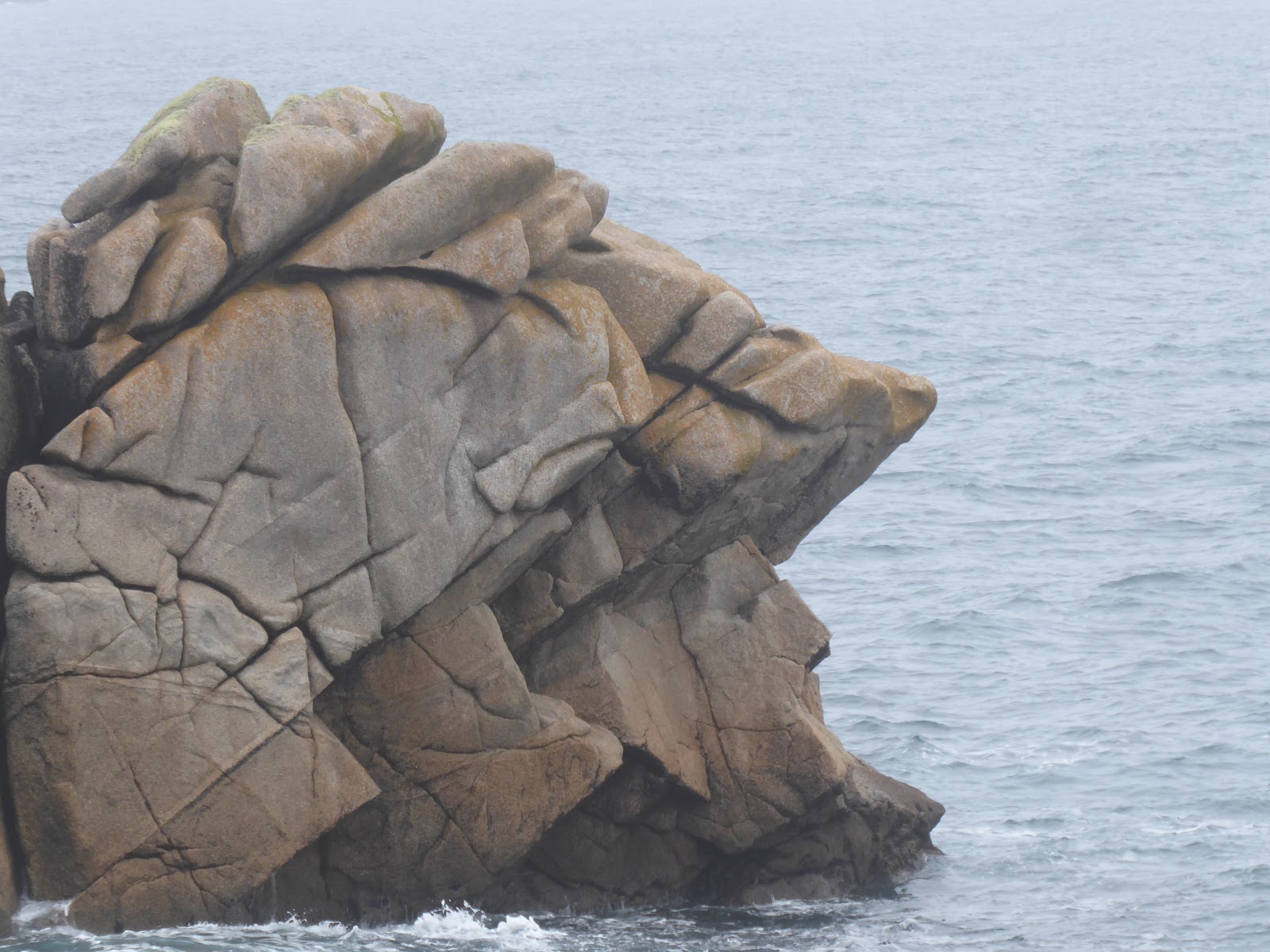
Can you see the face in the rocks?


There are as many as 80 prehistoric chambered tombs known on the Scilly Isles but this is one of the best preserved.


After a few hours walking I came across Juliet's Garden. With a fresh crab and lobster salad on the menu I was in heaven. Pity the weather wasn't a bit brighter but at least the rain had stopped.
It was a short walk around the coast back to where I was staying. What a fabulous walk it had been.


Monday, 11 November 2019

St Mary's Isles Of Scilly

The weather was not looking good for today so I decided to stay on St Mary's island and have a look at the garrison which has an array of defensive buildings and ruins.

The entrance to the garrison
This is an aerial photo of the Garrison showing Hugh Town with the harbour on one side and Porthcressa beach on the other.

The Isles of Scilly occupy an important strategic position near the entrance to the English Channel. From Tudor times in the 16th century the islands became an important harbour and base for naval seaborne operations. The harbour at Hugh Town emerged as the most important anchorage in the islands. To prevent it falling into enemy hands, fortifications were begun in 1551. The garrison was begun in 1593, extended during the English civil wars  (1642-51) and rebuilt in the 1740s. It remained as a defended place until the end of the Second World War in 1945.


The Garrison overlooks the St Mary's harbour.

This is the powder magazine

In the Second World War, only St Mary's was defended, by 500 infantry and an artillery troop with two anti-aircraft guns. A squadron of Hurricane fighter aircraft was based on the island, and fast motor launches of the Royal Navy and Royal Air Force carried out rescue missions from the harbour, for pilots who had been shot down. German aircraft made several attacks especially on the radar station at Peninnis Head but no invasion was attempted.


The seas around the Isles of Scilly are among the UK's busiest and most perilous stretches of water. There have been numerous shipwrecks from Bronze age cargoes to 20th century submarines. The western rocks are particularly treacherous. 1400 lives from Sir Clowdesley Shovell's fleet were lost in one night in 1707. In total there are over 772 recorded losses and 77 known wreck sites within 5km of St Mary's alone, many of which are of archeological, historical or artistic importance.

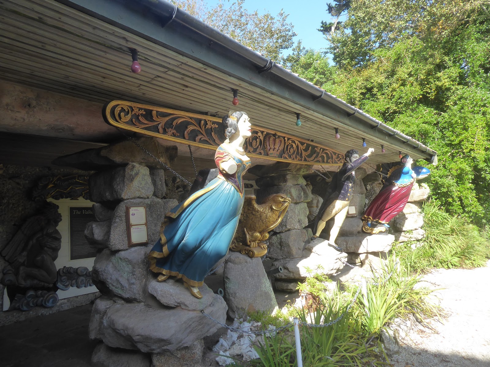
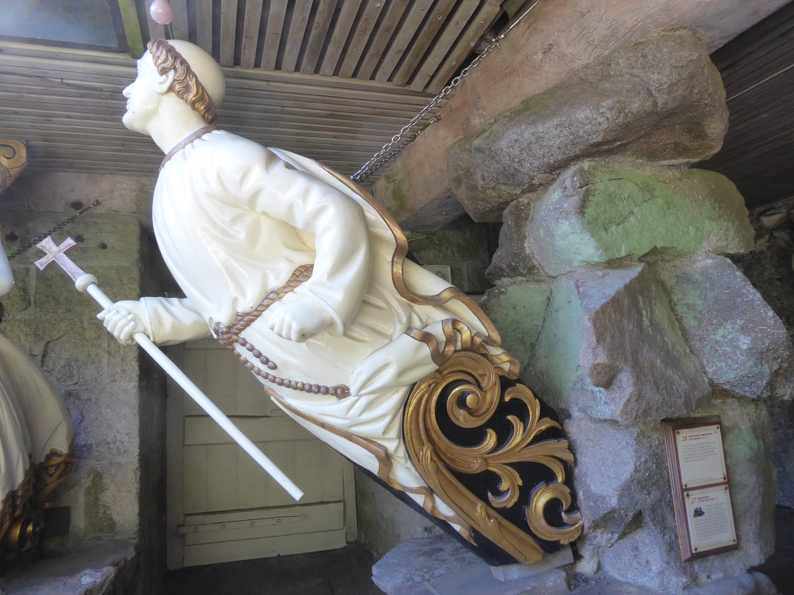
 When I visited Tresco island there were a number of ship's figureheads on display in the gardens that had been recovered from shipwrecks. Here are just a few:


It was raining heavily now and I put on my waterproof trousers but it wasn't pleasant walking conditions.


Continuing my walk around the Garrison I came to the Morning Point Battery. Guns on Morning Point guarded the approach to Porthcressa Beach from St Mary's Sound from at least 1655. The battery that we can see today is from the 1740s built into an outcrop using stone from shallow quarries nearby. Later it had five nine pounder guns.


 I had now walked around the remains of the garrison and was ready to return to Hugh Town to have a hot drink and something to eat.


As I am walking back  I have a good view of Porthcressa beach which is on the other side of Hugh Town.
Sharing with
Our World Tuesday

Thursday, 7 November 2019

Bryher, Isles of Scilly

This is Bryher, the smallest of the inhabited  Scilly islands. Less than 100 people live here. It is an island of contrasts. One side faces the might of the Atlantic waves whilst the other side has calm sandy beaches. It is only one and a half miles long but is zig-zagged with paths so feels bigger.


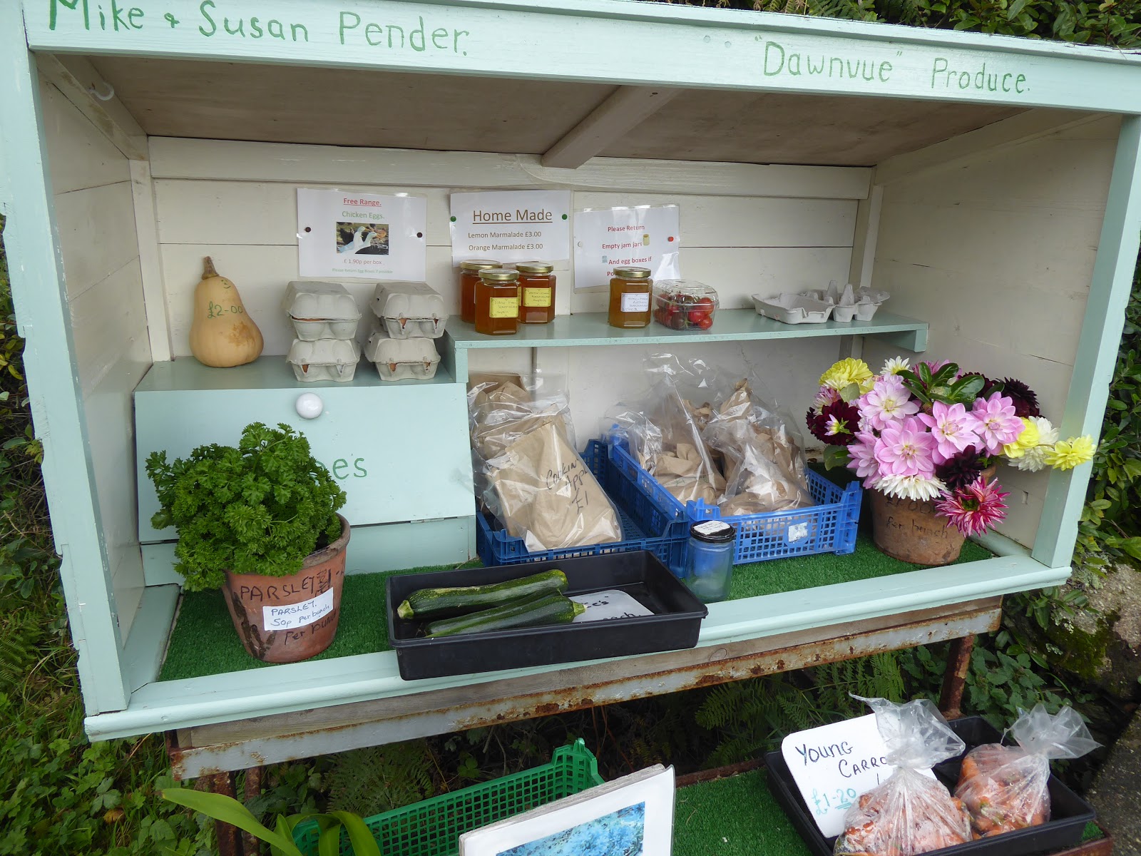
Dotted around the island are these little stalls selling a variety of fresh produce. The items are all clearly priced and you leave the money in the honesty box.


As you can imagine there are not many places to eat  on the island. This is Fraggle Rock Bar which was closed when I ambled past. I had been warned that, as it was late in the season, places would probably be closed so I had brought some food and drink with me.


I could have spent all day just watching these waves crashing onto the rocks. Perfect lunch stop.


No sign of those waves on the other side of the island.