The rain was beating against the windows when we awoke. So it was on with the waterproofs. Tina decided to keep the legs out and bravely shunned the overtrousers despite it being a little chilly. Another group photo, kindly taken by the owner of 'The Old Water View'. Tina and I didn't want to leave this morning as our room was so cosywith such comfy beds and the food was great. A couple of Canadians staying there decided to wait until tomorrow and hope the weather would improve before they set off walking again. We didn't have much choice as we have a strict itinerary to follow or we'll end up with nowhere to stay.

 The clouds were low over the mountains and rain was forecast for most of the day.

Still time for a photo stop though.

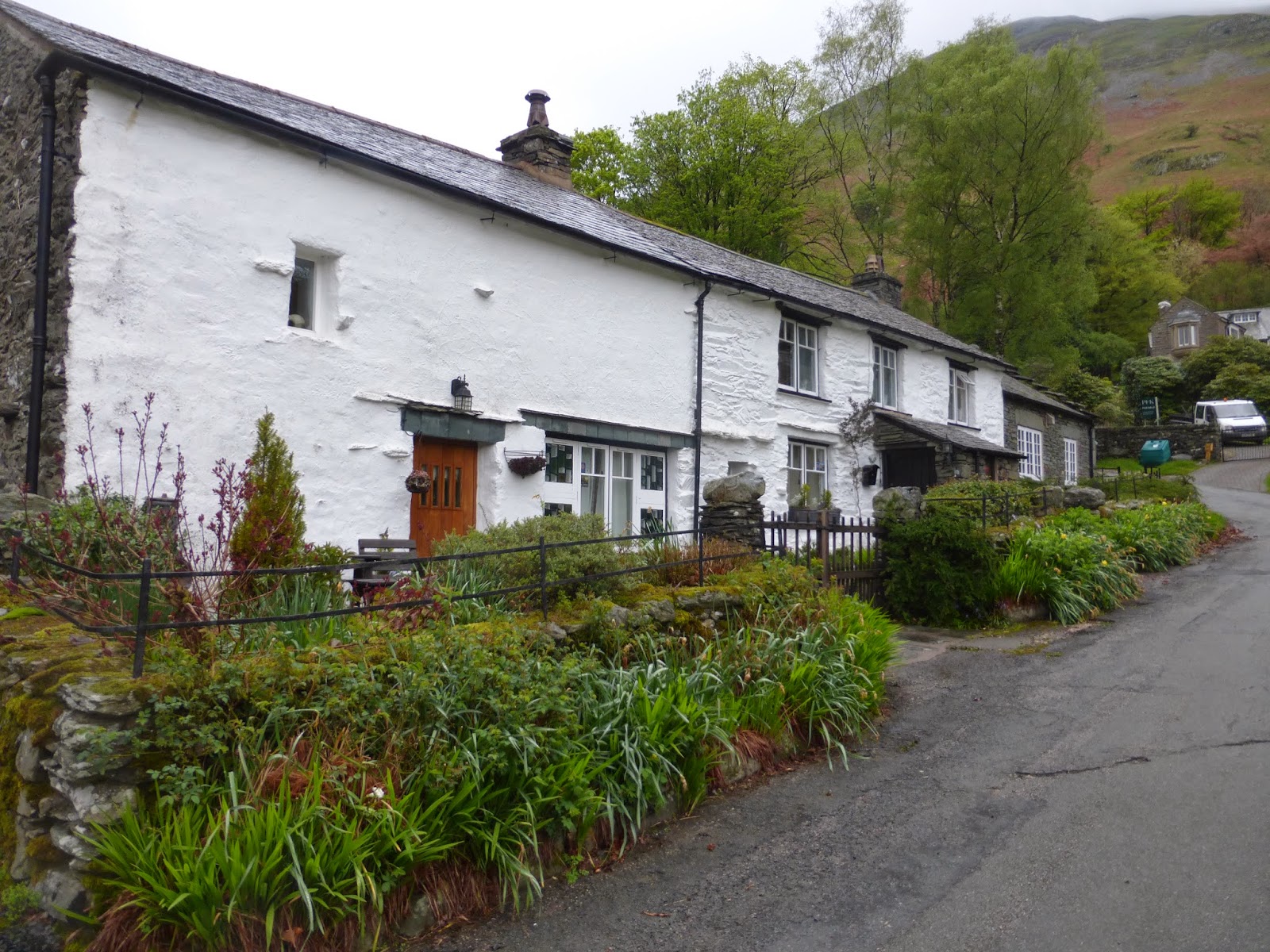
We walked up the road with these beautiful stone cottages lining our route.


As we began our climb towards the top of Kidsty Pike we looked back towards Ullswater. Despite the cloud and mist it still looked beautiful.

We hadn't been walking for that long when there was a discussion between Tim with the GPS gizmo and Paul with his beloved guide book plus OS map about whether we were on the correct path. In fact we were going in the wrong direction. I'm sure one morning we will get this right. Today we have 16 miles to cover but that has now increased to 17+ miles!
 In yesterday's post I mentioned the helicopters taking large rocks up to the Helvelyn range to repair the paths. Well despite the low cloud we caught a glimpse of them today with a large white container full of rocks flying over towards our route from yesterday.
 One last backwards glance towards Ullswater and then it was a hard slog up the mountain.


It wasn't long before we were enveloped in the mist and cloud. There would be no spectacular views from the top today. Yes that is Tina braving the cold in her shorts.

That's if we find the top! Another map huddle.

Stop laughing at them Jim!


We seemed to come across group after group who had lost their way on the mountain. At one point our group of 6 had increased to 13, as people asked if they could follow us over the top.


We knew we were on the right track when the water at Angle Tarn came into view.
 Today we reached the highest point on the Coast to Coast walk at Kidsty Pike (2560ft). This is the group on the last stretch up to the top. The wind was fierce and visibility very poor.

 But now we could begin the descent. I managed to fall just the once and luckily rolled into a bog stopping myself from rolling further down the mountain. It was a soft landing but very wet. At least no-one had a camera to record the event!
 It was quite a precarious downhill clamber and the going was slow. Then we were below the clouds and we could see Haweswater Reservoir.
 This used to be a lake with the village of Mardale, a small farming community, at its centre. In 1935 the village was flooded so that the lake could be dammed to hold more water and become a reservoir to provide water for the city of Manchester. As you can imagine there was a lot of opposition to this drastic move but nevertheless it went ahead. Whenever there is a drought people flock to the area to see the ruins of the village exposed as the water retreats.


Today was our last climb over the Lakeland fells as we now leave the Lake District National Park. These gushing waterfalls a reminder of the steep slopes we have come down today.

 As we walked around the edge of the reservoir it was important that we picked up speed as it was mid afternoon and we still had 9 miles to go.
 The walking was much easier until we noticed we had to climb again.
 Fortunately for our legs it wasn't too far to the top.


It looked as though there had been some recent rock falls as the path was strewn with rocks.

Once we had left the path alongside the reservoir we came across this old sign for the village beneath the water.
 A rare sign mentioning the coast to coast. Now that we are out of the National Park I imagine we will see far more of these signs.


Naddle Bridge. What a great name for a bridge.


 Rosgill Bridge
 This was an unusual stile as it had a gate at the top as well.

 This is Packhorse bridge. Such a beautiful old bridge.


Just one last hill from here to take us to the village of Shap.

As you can see from this photo all six of us were there so who took the photo? Two unsuspecting runners just happened to be on a training run as Paul stopped them and asked them to take this shot. The poor runners were so stunned they just did as they were asked. So thank-you!
It was now 6 pm and we were all hungry. We stopped at a pub in the village for some food and drink and then walked to our place of rest for the night - Brookfield. It was the last house in the village and Margaret, our host, was waiting to greet us with a pot of tea and some home made cake. Delicious.


Still time for a photo stop though.

We walked up the road with these beautiful stone cottages lining our route.


As we began our climb towards the top of Kidsty Pike we looked back towards Ullswater. Despite the cloud and mist it still looked beautiful.

We hadn't been walking for that long when there was a discussion between Tim with the GPS gizmo and Paul with his beloved guide book plus OS map about whether we were on the correct path. In fact we were going in the wrong direction. I'm sure one morning we will get this right. Today we have 16 miles to cover but that has now increased to 17+ miles!


It wasn't long before we were enveloped in the mist and cloud. There would be no spectacular views from the top today. Yes that is Tina braving the cold in her shorts.

That's if we find the top! Another map huddle.

Stop laughing at them Jim!


We seemed to come across group after group who had lost their way on the mountain. At one point our group of 6 had increased to 13, as people asked if they could follow us over the top.


We knew we were on the right track when the water at Angle Tarn came into view.


Today was our last climb over the Lakeland fells as we now leave the Lake District National Park. These gushing waterfalls a reminder of the steep slopes we have come down today.


It looked as though there had been some recent rock falls as the path was strewn with rocks.

Once we had left the path alongside the reservoir we came across this old sign for the village beneath the water.


Naddle Bridge. What a great name for a bridge.


We were now crossing over farmland and numerous stiles.


Yet another bridge with the ruins of Shap Abbey in the background. The Abbey dates back to 1200.

Just one last hill from here to take us to the village of Shap.
As you can see from this photo all six of us were there so who took the photo? Two unsuspecting runners just happened to be on a training run as Paul stopped them and asked them to take this shot. The poor runners were so stunned they just did as they were asked. So thank-you!
It was now 6 pm and we were all hungry. We stopped at a pub in the village for some food and drink and then walked to our place of rest for the night - Brookfield. It was the last house in the village and Margaret, our host, was waiting to greet us with a pot of tea and some home made cake. Delicious.

So what's an extra mile or two when you're having so much fun? And tea and cake waiting for you! How sweet is that? :-)
ReplyDeleteIt's a shame you missed the views from the tallest peak, but a lovely walk anyway. The yellow flowers on the bushes are so colorful despite the rain.
ReplyDeleteBoy that is serious walking and in the wet and cold but the scenery is fabulous. It is amazing how much beautiful scenery and diverse scenery there is in such a small country. beautiful England!
ReplyDeleteIt's a pity that you have such a bad weather too ! The landscapes look so beautiful ! You are all so well equipped to climb through the mountains !
ReplyDeleteThere are not many landscapes which looks still fine in rain, fog or whatsoever. But where you are walking beautiful despite of the weather conditions. I love to see this. Thanks for showing.
ReplyDeleteI have been enjoying your adventures very much. The misty fog pictures reminded me of our area. Good that you were able to gather up all the stray hikers who seemed to get lost. And those bridge pictures are wonderful! :-)
ReplyDeletegetting lost with all that gear I am supprised. I hope the GPS is a Mapping on and not a cheap Ertix you need good kit for what your doing. I've driven up shap on the motorway, it's steep
ReplyDeleteWhat an adventure! Looks really cold but fun. Love the shots and will go now and see what you have been up to of late.
ReplyDelete